Leaving Mzuzu and Traveling North
Pulling out of Mzuzu, the capital city of northern Malawi, at 3 PM on the M1, our driver quickly drops the visor to shield his eyes from the afternoon sun. It is the African sun, and it appears to grow larger as it inches closer and closer toward the western horizon. Soon it will be a blazing sphere illuminating the entire western horizon from north to south. Our destination for the night is the old slave trading center of Karonga, located on the northern shore of Lake Malawi. Our map says it is 275 kilometers, or 171 miles to the border. The center of Karonga means something different to modern day Malawians, but to those of old it was a place where families were separated forever; where people suffered and died; where grief and pain followed the footprints of thousands of shackled people. Today it is a thriving trading center at the north end of the country, and has a claim to fame for the discovery of the bones of an ancient dinosaur. A little way south of Karonga, nestled comfortably in the mountainous area of the Rift Valley, rests the mission center of Livingstonia. It is quite a contrast: a place where slaves were sold just a little way north of a symbol of the end of slavery. But, as we approach the north edge of Mzuzu, these places are still some distance up the road. In the beginning our westerly swing puts the afternoon sun directly in our path. The map actually makes note of the fact we will soon see, “some of the most magnificent scenery in Africa.” Everyone is scanning the road ahead of us to see what is coming next.
The bus passes the Mzuzu airport on the right, and then without advance notice there are university buildings slipping by on our left. Finally the road begins a slow climb as the town is left behind on lower ground.
Passing Through Tumbuka and Angoni Lands
In just a few minutes we pass the Ekwendeni Trading Center, and off in the distance we see mountains higher than any we have seen since leaving the lowlands near the capital. Someone notes that years ago Ekwendeni was larger than Mzuzu, but today the district capital has left the smaller trading center in its dust. The afternoon sun and shadows are already casting a pale, grey, shroud over the distant range. The forests that covered the landscape south of Mzuzu are now gone, even though there are more trees than in the central region immediately around Lilongwe.
This area is heavily Tumbuka, mixed with Angoni, as compared to the prominence of the Chewa in the center of the country. As we glide through this land of mystery and intrigue I realize the afternoon sun is quietly burning my left ear. It is time to pull out the large brimmed hat. I am quickly learning why the stereotype of the clothing of the 19th century European explorer was probably correct. I have learned their fashion was not for effect, or to be dashing heroes in a far off land, but for practicality. Hat on, sun now held somewhat at bay, we continue on course toward Kronga. It is then I notice the four Malawians had taken seats on the right side of the bus back in Mzuzu. I had taken the seat next to the driver on the left side. Traveling north this puts the sun directly on the left side of my face as we make our way north. They, on the other hand, are sitting in the shade looking out the window with ease. I must determine to be more attentive the next time.
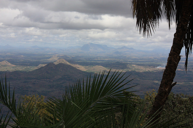
Palm Trees That Symbolize Slavery
Off to the west are a series of very tall palm trees. Knowing these were the markers for the Arab slave trade a little over 100 years ago I wondered what the origin was of this small group of trees. On a hill to the right are trees whose leaves are already beginning to turn yellow. They are more like the trees of North America and are easily influenced by the lower temperatures and coming dry season of the sub-Sahara.
As we skim along the tarmac we soon catch up with an old, dilapidated, white pick up truck loaded with 18 mattresses that are stacked clear to the ceiling. In other words, they have stacked them far, far too high. I watch to see when he rounds a curve if the truck and its fluffy contents will flip over beside the road. As they round the next curve I think to myself, “Well, if this is the one, at least they will have something soft to land on when they flip over.” Eventually we move out into the oncoming lane and pass them. From now on they are on their own as they sweep around curves that most certainly place the mattress load on the edge.
The Road To Nyika National Park
At around 3:40 we pass the M24 turn off to the trading center of Rumphi, and the entrance to the Nyika National Park. Rumphi is the main trading center for the farming areas off to the west, while to the north rests one of the most famous, and largest game parks in Malawi. Nyika holds a delight for anyone interested in scenery, flora, fauna, and animals. An earlier trip to the park reminds us of how many animals we had seen. Eland, bushbuck, grey druker, kudu, reedbuck, baboon, zebra, and even the elusive leopard had been part of our picturesque trip the park. Hot meals on a cold night, accented with fireplaces burning brightly when it came time to retire, now beckon us to make a hard turn to the left and head for the Nyika Plateau again. Time and mission, however, make this side trip impossible and the trip only takes place in our minds. Left behind on the travel map is also the Vwaza March Wildlife Reserve to the west and south of Rumphi. Unlike Nyika to its north, the Reserve holds more of a desert landscape. Here thrive buffalo, elephant, hippopotamus and several species of antelope, as well as large varieties of birds. They seem to prosper around the Kazuni Lake, and south Rukuru River. For us it is out of sight, even though we can plainly see the higher mountains off to the west, and the road that appears to hold them at bay, as though the tarmac offers some sort of threat. Perhaps someone has told them the tarmac road can tear a hole through a mountain pass just as surely as an Angoni war spear can slash through a human body. The road, on the other hand, seems to also be wary of the mountains, so it appears to be some sort of agreed standoff, both of them avoiding each other.
Little Girls With Bundles Of Something
Little girls with bundles of something wrapped in pieces of cloth suddenly appear from over distant ridges going somewhere. Looking into the fields along the highway one can easily see land more fertile than what is found in the central region. It is another of the reasons why the north is more prosperous than the central.
A highway crew of 6 or 8 are doing road repair by hand. Spotted along the road for several hundred kilometers are the small rectangular sections where the pavement has been marked for repair.
Coming into view more and more are the ever-present palm trees. We enter a little focal point called Phewzi center. It is nestled under the windward side of a mountain that has kept our view from the lake for several kilometers.
Then the road makes an abrupt sweep to the east toward the lake and the historic seaside center of Livingstonia.
By four PM the late afternoon shadows immerse the bottom of the valley in a coming hint of darkness, and the heat of the African sun makes way for the coolness that belies the warmth of earlier in the day.
When You Don’t Pay For The Bananas
Bananas along the road wait to be purchased. Most are sitting at little buckets set on top of rocks. There are no attendants. The legend concludes if you take the bananas without paying for them you will go along the road and your stomach will grow heavier and heavier. You will become sicker the longer you travel and the farther you get from the crime you have just committed. You must return to pay for the bananas. You must turn back. Then the closer you get to the site the less illness you experience. But then when you arrive the people will know, and ask what you have done. You will confess your sin. They will then charge you for a crime, and you must pay a fine. Only after that can you pay the original price for the bananas and go your way, and only then will you be well again. As we pass more of the unattended banana booths I can not help but admire the system that insures that everyone pays for their bananas, whether someone is watching the cash register or not.
Coalmines Of The North
Soon we pass the first of a number of coalmines that dot this region of Malawi. The coal is sold primarily to production plants in Lilongwe and Blantyre. As we pass the major mine entrance we also come up alongside the South Rukuru River. It rushes along, uncaring about who is watching, as it rushes to its appointment with Lake Malawi.
Just then the bus makes an abrupt turn off of tarmac and draws to a stop. We have just passed friends from Ekwendeni driving along the highway, and no one would think of continuing the journey without both groups stopping to visit. Everyone piles out of the bus and a number of folks exit the 4 and 4. Then a reunion of sorts takes place right in the roadway. A couple of cars swerve to avoid the gathering but no one seems to take heed, and no one rushes to get off of the roadway. Then, with the visit over, everyone shakes hands all around and climbs back into their respective vehicles. By now it is late, and the driver speeds up to make his appointment with a steep mountain road before the sun blots out the spectacular view that awaits us just a few curves ahead. It is going to be a race against the coming darkness, and the sun is headed for a meeting with the horizon. It also seems to be cheating just a bit, as it seems evident it is speeding up as it heads unheeded toward the horizon.
An Old, Dilapidated, Wooden Bridge
An abrupt speed bump warns of an old wooden bridge over the South Rukuru River. Apparently the road is now moving toward the lake at just the right angle, so the river decides to tag along just for fun and torment the road at every curve along the way. It must be a race to see which one of them can reach the lake first.
The mountain road grows steeper, the curves sharper, and the suns heads down faster, but now the bus is making the twists and turns slower. Suddenly we reach a sweeping curve and look out over a cliff and off in the distance toward the lake. It appears to be tangled up in the tree branches along the steep embankment and… well the words “some of the most magnificent scenery in all of Africa” cannot fully do this scene justice. Right you are. We begin to wind slowly down the mountain road toward the valley floor. Slowly. Have you noticed they have no guardrails on Malawi mountain roads? Guess that keeps away unsightly metal and wood from distracting the visitor from the awesome sight that awaits them around each turn. Slowly. Slowly. Why did I take the front seat in the bus? There are certainly advantages to riding in the back.
The Spirits Removed The Tarmac
Part way down the mountain we come to a short stretch of road where the tarmac is absent. A concrete strip has replaced it. The local story about this stretch of road explains that the highway was apparently built over a cemetery, or at the least it was built in a place where the spirit world had much influence. The tarmac was put down, and it slid off the hillside. The spirits did not want it there. It was put down again, and again it slid away. Only the long slab of concrete could hold off the spirits who sought to move the highway out of the way. As we passed over the site I wondered what the real story was for this stretch of road. I tried to convince myself it was the steep incline, but other nearby stretches of road contained steeper inclines. I suggested to my mind it was probably the truck traffic that beat off the tarmac, but the big trucks traversed the entire mountainous area. One last time I suggested to myself it was the heat of the sun, but that one also seemed lame. Finally I turned my attention back the road ahead. I learned a long time ago there are many things about Africa that I cannot understand, and never will. Maybe this stretch of road is one of them.
Finally the bus reaches the bottom, and a quick loop brings us back on course to the north. The lake is now beside us (you guessed it, on the right side of the bus and I am on the left), and the tiny pencil points in the valley a few minutes ago have grown into the full-grown villages. The price of lake front property along this stretch must be through the roof, rivaled only by the houses that sit higher on the ridge overlooking the lake. Malibu, eat your heart out! It is at this location one can imagine, off to the left and up on the mountainside, the famous Livingstonia Mission. This is the place the Scottish missionaries settled after their exit from the original site near Cape Maclear was made necessary by the mosquitoes and malaria drove Dr. Robert Laws out of the southern Lake area.
Karonga Is Only 90 Kilometers Away
The road crosses the North Rumphi River Bridge, and then begins slow sweeping curves that match the shoreline of the lake. Small, well-stocked stores line the highway, and the family farm gardens are more in evidence even in the dry season. The fact that this region is more prosperous than the central region is quite evident, and it can be seen even in the dress of those walking along the road. Drab grays and browns make way for colorful plaids, oranges, yellows and reds. Only the log fishing boats, the thatch houses that dot the hillside, and the people who must walk everywhere they go remind the visitor of the ever-present poverty that dominates the region, yes even the entire sub-Sahara. In moments we could see the fact the rivers across the nation all run into the big lake. The road crosses the Bogola River, and then it cautious approaches a police guard post. We can see the policeman mouthing the letters of the Malawi Project that are on the front of the bus as he motions us through the station. A sign reads “Chilumba 25 kilometers” “Karonga 90 kilometers”. Still a fair distance and the sun is about to give way to the shadows. The waters of the Zuza Rivers hurtle past under a bridge, well down under us and then collides a few hundred feet away with the serene waters of Lake Malawi. I am reminded of the Bible verse, “All of the rivers run into the sea yet the sea is not full …” Another river bridge, then three more in quick succession.
We Are Just A House and A Beach From The Lake
The road moves to a distance of just a house and a sandy beach from the waters edge, and then smoothes out for the first time since leaving Mzuzu. The sun is playing peek-a-boo over the distant mountains, and at 5:20 it is evident darkness is coming, and coming at breakneck speed, in order to conquer the landscape. The bus speeds up, but it is evident the last kilometers into Karonga will be in the dark. Distant mountains, green earlier in the day, are now pale grey as the last shades of light race off to the west in a vain attempt to keep up with the sun. Little girls walk along the road with bundles of firewood on their heads, enough wood for their cooking fires for another day. Bicyclists trace the yellow lines along the edge of the road in a masterful dance between the traffic just to their right, and the pedestrians so close on the left.
Four more small rivers cross under M-1, and one must wonder how much water can empty into one lake on a busy day. An ox drawn cart bounces into the end of day, and a number of people appear, rushing into an evening marathon. Another palm is seen near the water’s edge.
Night Cascades Over The Horizon
Night cascades over the horizon, and the final rays of day outline the evening sky. At 7 P. M. we roll into the outskirts of Karonga. In the distance the lights on fishing boats signal the return of fishing vessels that have plied the lake during the day. Then, over the next ridge, a few lights appear. It is the city of Karonga, the 1st major city in the north when one enters Malawi from the north, or the last city in Malawi before exiting into Tanzania from the south. It depends on which way you are going … or coming. Karonga appears to be sort of run down today, but its past holds a rich heritage. It was once the headquarters of the famous slave trader Mlozi. He controlled much of the surrounding area with his well-trained army. It was also a center for the African Lakes Company, and was a focal point of an effort on the part of African East Africa (now Tanzanian) to capture the town during World War I. A local group of the famous King’s African Rifles held the town and the invading force was rebuffed. We wind down pothole filled streets until we reach the Mufwa Lakeshore Lodge. It is a little run down and in need of a can of paint (or several of them), but the beds are nice, the mosquito nets secure, and the evening meal is both filling and inviting. A good nights rest prepares us for the final dash to the border for a 9 AM meeting with friends from America coming down to meet us from the north.
A Final Dash To The Border
The next morning we walk down to see the lake before another filling meal, and the trip back to M1 in order to make the 49-kilometer (30 mile) trip to the border. It is 8:15 and we arrive without incident and on time. It’s a good thing, as we find only a small village, Iponga, a short distance south of the border. The actual border crossing leaves nothing to do and no place to go if you are on foot. Our friends have arrived ahead of us, and they have already processed through. They are standing beside a large steel gate as through they have no place else to go. That is pretty correct for such a remote location. We quickly pack them into the bus, and the driver gains permission to drive through the gate and into Tanzania long enough to turn around and head back south into Malawi. As we turn back to the south we recognize the road from the other side. This time I have it all figured out. I am going to sit on the side of the bus toward the east. I suddenly realize I have the sun directly on the left side of my face. I guess it all has its perspective, depending on which side you sit on and what time of day it is. I tip my hat down a little in order to cover my left ear. The driver pulls the visor down to protect his eyes, and we head south.